EYES IN THE SKY: HOW SATELLITE TECHNOLOGY REVEALED THE TRUE SCOPE OF OPERATION MIDNIGHT HAMMER AND TRANSFORMED MODERN WARFARE ACCOUNTABILITY
The age of hidden warfare ended definitively on June 22, 2025, when high-resolution satellite imagery captured by Maxar Technologies provided unprecedented documentation of the devastating effectiveness of Operation Midnight Hammer’s strikes against Iranian nuclear facilities. These digital witnesses orbiting hundreds of miles above Earth transformed what might once have been shrouded military operations into transparent displays of destruction visible to anyone with internet access, fundamentally altering how modern conflicts are documented, analyzed, and understood by global audiences.
The stark before-and-after images of the Fordow, Natanz, and Isfahan nuclear facilities represent more than simple documentation of military success—they illustrate the revolutionary impact of commercial satellite technology on international transparency, strategic communications, and the verification of military claims that previously relied on government assertions and classified intelligence. The ability to independently verify the extent of damage to deeply buried nuclear facilities through space-based observation has created new standards for accountability in military operations while also providing unprecedented insights into the capabilities and limitations of modern warfare technology.
THE SATELLITE SURVEILLANCE REVOLUTION
The commercial satellite industry’s evolution from government monopoly to private enterprise has fundamentally transformed international relations by democratizing access to intelligence-quality imagery that was once available only to major powers with extensive space programs. Companies like Maxar Technologies, Planet Labs, and others now provide near real-time imagery with resolution sufficient to identify individual vehicles, buildings, and infrastructure changes that enable independent analysis of military operations and international events.
The technical capabilities of modern commercial satellites have reached levels that rival or exceed the classified reconnaissance satellites of previous decades, with resolution approaching 30 centimeters per pixel and revisit times that enable multiple observations per day of any location on Earth. This technological advancement has created unprecedented transparency in international affairs while also creating new challenges for operational security and strategic surprise.
The proliferation of satellite imagery analysis capabilities has extended beyond government intelligence agencies to include academic institutions, think tanks, non-governmental organizations, and even individual researchers who can access and interpret high-quality imagery through commercial providers. This democratization of intelligence capabilities has created multiple independent sources of verification for military operations and international events.
The real-time nature of modern satellite coverage enables rapid assessment of developing situations and near-immediate verification of government claims about military operations. The ability to task satellites for specific coverage of developing events provides responsive intelligence capabilities that can influence international responses and diplomatic negotiations.
The integration of artificial intelligence and machine learning technologies with satellite imagery analysis has enhanced the speed and accuracy of damage assessment while enabling automated detection of changes and anomalies that might be missed by human analysts. These technological advances continue to improve the effectiveness of space-based surveillance and analysis.
TECHNICAL ANALYSIS OF UNDERGROUND TARGET ASSESSMENT
The challenge of assessing damage to deeply buried facilities like those at Fordow represents one of the most complex aspects of satellite-based damage assessment, requiring sophisticated analysis techniques that can infer underground effects from surface indicators and crater characteristics.
The Fordow facility’s construction approximately 80-90 meters underground within natural mountain protection created unique challenges for both attack and assessment that required specialized weapons and analytical techniques. The use of massive ordnance penetrator (MOP) weapons specifically designed for deep underground targets created distinctive surface signatures that experts can analyze to assess underground damage.
The crater analysis conducted by munitions specialists like N.R. Jenzen-Jones of Armament Research Services involves examining crater size, shape, and distribution patterns to determine weapon types, impact angles, and penetration effectiveness. The “larger, central entry holes” visible in satellite imagery provide evidence of successful penetration of hardened targets.
The presence of gray ash and debris patterns around impact sites provides additional evidence of underground explosions and the dispersal of facility contents that would not be visible if weapons had failed to penetrate to their intended targets. These surface effects enable analysts to infer the extent of underground damage even when the actual target facilities remain invisible.
The analysis of tunnel entrances and access points provides additional insights into facility status and potential countermeasures taken to contain damage or prevent further infiltration. The filling of tunnel entrances with soil observed at Isfahan suggests either containment efforts or acknowledgment that underground facilities have been compromised.
THE FORDOW FACILITY: PENETRATING MOUNTAIN FORTIFICATIONS
The Fordow Fuel Enrichment Plant represented the most technically challenging target in Operation Midnight Hammer due to its construction within natural mountain protection specifically designed to withstand nuclear attack. The facility’s location and fortification made it virtually invulnerable to conventional weapons, requiring the most advanced penetrating munitions in the American arsenal.
The satellite imagery analysis of Fordow reveals at least six distinct impact craters that penetrated the mountain surface to reach underground facilities housing uranium enrichment centrifuges. The precision required to target specific underground locations through mountain rock demonstrates sophisticated intelligence gathering and weapons guidance capabilities.
David Albright’s assessment from the Institute for Science and International Security suggests “considerable damage” to enrichment halls and support facilities that would effectively end Iran’s ability to produce highly enriched uranium at this location. The potential for “total destruction of the underground hall” indicates that even the most protected nuclear facilities remain vulnerable to advanced weapons.
The technical challenge of attacking underground facilities involves not only penetrating protective barriers but also ensuring that explosive effects are properly contained and directed to maximize damage to intended targets while minimizing environmental release of radioactive materials.
The success of the Fordow attack validates decades of investment in bunker-busting technology while also demonstrating that no underground facility, regardless of protection level, can be considered invulnerable to determined attack with appropriate weapons and intelligence.
Fordow
Before
After
NATANZ: COORDINATED MULTI-NATIONAL TARGETING
The Natanz Nuclear Facility’s targeting by both Israeli and American forces within a nine-day period represents unprecedented coordination between allied nations in attacking Iranian nuclear infrastructure. The satellite imagery reveals the cumulative effects of multiple attack waves against different aspects of the facility’s above-ground and underground components.
The initial Israeli attack on June 13 focused on above-ground buildings and infrastructure that provided support services for underground enrichment operations. The visible damage from this attack created intelligence opportunities for subsequent American targeting of underground facilities that had been exposed or made more vulnerable.
The American follow-up strikes, visible in satellite imagery as dark craters positioned above underground facilities, demonstrate sophisticated targeting that avoided redundant attacks on already damaged areas while focusing on previously untouched underground infrastructure. This coordination required detailed intelligence sharing and target deconfliction between allied military forces.
The multiple underground structures at Natanz housed thousands of uranium enrichment centrifuges representing years of Iranian investment in nuclear technology. The successful targeting of these underground facilities effectively eliminated Iran’s primary uranium enrichment capability while destroying equipment that would require years to replace.
The combined Israeli-American attack on Natanz illustrates the effectiveness of coordinated operations that leverage different national capabilities and intelligence assets to achieve comprehensive destruction of complex target sets that might be difficult for any single nation to address completely.
Natanz
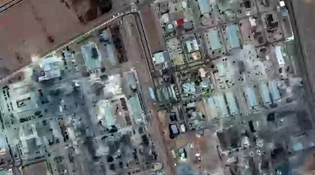
ISFAHAN: COMPREHENSIVE FACILITY DESTRUCTION
The Isfahan Nuclear Technology Center represented Iran’s largest and most comprehensive nuclear research complex, housing uranium conversion facilities, research reactors, and various support functions that made it crucial to Iran’s overall nuclear program. The satellite imagery reveals devastating damage that effectively eliminated decades of nuclear research and development capabilities.
The transformation of the Isfahan complex from an intact facility visible in June 16 imagery to a landscape covered in ash and rubble by June 22 demonstrates the comprehensive nature of American targeting and the effectiveness of precision weapons against complex target sets. The visible destruction of multiple buildings across the large complex required extensive weapons employment and precise coordination.
The Institute for Science and International Security’s assessment confirming “heavy damage” to the facility included specific observations about tunnel entrances filled with soil, indicating either containment efforts or acknowledgment that underground portions of the facility had been compromised. This detail suggests that even underground components of the Isfahan complex suffered significant damage.
The targeting of Isfahan’s uranium conversion facility, which processes natural uranium into forms suitable for enrichment, represents strategic targeting that addresses the entire nuclear fuel cycle rather than focusing solely on enrichment activities. This comprehensive approach effectively disrupts Iran’s ability to produce nuclear fuel even if enrichment facilities were rebuilt.
The scale of destruction at Isfahan, visible in satellite imagery as complete devastation across a large complex, demonstrates the enormous destructive power that can be brought to bear against fixed targets when precision weapons are employed systematically against comprehensive target sets.
Isfahan
Before
After
INTELLIGENCE VALUE AND STRATEGIC COMMUNICATIONS
The satellite imagery documenting Operation Midnight Hammer’s effects serves multiple strategic communication purposes beyond simple damage assessment, providing visual evidence of American military capabilities while sending deterrent messages to other potential adversaries considering nuclear weapons development.
President Trump’s reference to satellite imagery in his Truth Social statement claiming “Monumental Damage was done to all Nuclear sites in Iran, as shown by satellite images” demonstrates the strategic value of visual evidence for validating government claims and building public support for military operations.
The availability of independent satellite imagery analysis by non-governmental experts provides credibility for damage assessments that might otherwise be dismissed as propaganda or exaggeration. The confirmation of extensive damage by independent analysts strengthens the credibility of American claims about operational success.
The global accessibility of satellite imagery through commercial providers means that international audiences, including potential adversaries, can independently assess American military capabilities and the vulnerability of hardened targets to advanced weapons systems. This transparency serves deterrent functions that extend far beyond the immediate Iran context.
The precision evident in satellite imagery—showing successful targeting of specific underground facilities while avoiding collateral damage to surrounding areas—demonstrates American capabilities for surgical military action that can achieve specific objectives without broader destruction.
ENVIRONMENTAL AND SAFETY IMPLICATIONS
The satellite imagery analysis of nuclear facility attacks requires careful attention to environmental indicators that could suggest radioactive contamination or other hazardous material releases that might affect regional safety and international legal obligations.
The absence of visible environmental indicators of radioactive release in satellite imagery supports official claims that the attacks successfully avoided dispersing nuclear materials into the environment. However, satellite imagery has limitations in detecting certain types of contamination that might require ground-based or aerial monitoring to identify.
The filling of tunnel entrances with soil observed at Isfahan suggests either containment efforts to prevent environmental release or acknowledgment that underground facilities had been compromised in ways that created potential environmental hazards. This activity indicates awareness of environmental risks and efforts to mitigate them.
The debris patterns and ash distribution visible in satellite imagery provide information about the direction and extent of material dispersal from explosive effects, enabling assessment of potential environmental impacts and the effectiveness of containment measures.
International monitoring organizations including the International Atomic Energy Agency rely partly on satellite imagery analysis to assess compliance with nuclear safety and security obligations, making independent verification of environmental effects crucial for international legal and regulatory purposes.
TECHNOLOGICAL LIMITATIONS AND ANALYTICAL CHALLENGES
Despite the remarkable capabilities of modern satellite surveillance, significant limitations remain in assessing the full extent of damage to underground facilities where much of the actual nuclear equipment and materials were housed during the Iranian strikes.
The inability of satellite imagery to directly observe underground damage requires analysts to infer underground effects from surface indicators, crater characteristics, and secondary evidence that may not provide complete pictures of actual facility status and equipment survival.
Weather conditions, seasonal variations, and atmospheric interference can affect satellite imagery quality and limit the timing of useful observations. Cloud cover, dust, and other environmental factors may prevent optimal imagery collection during critical periods following military operations.
The resolution limitations of commercial satellite imagery, while impressive by historical standards, may not be sufficient to detect certain types of damage or to assess the functionality of equipment that appears intact in overhead images but may have been damaged by shock, vibration, or other effects.
The time delays between satellite observations and image processing, analysis, and publication can affect the timeliness of damage assessments and their utility for rapid decision-making during evolving military operations or diplomatic negotiations.
VERIFICATION AND INDEPENDENT ANALYSIS
The role of independent expert analysis in validating satellite imagery assessments has become crucial for maintaining credibility and preventing misinterpretation of complex technical evidence about military operations and their effects.
Organizations like the Institute for Science and International Security and Armament Research Services provide specialized expertise in nuclear facility analysis and weapons effects that enables more accurate interpretation of satellite imagery than might be possible through general analysis techniques.
The peer review and validation processes used by reputable analytical organizations help ensure accuracy and prevent the propagation of erroneous assessments that could influence policy decisions or public understanding of military operations.
The integration of multiple analytical techniques—including crater analysis, debris pattern assessment, and comparison with historical imagery—provides more robust and reliable damage assessments than any single analytical approach could achieve.
The publication of analytical methodologies and supporting evidence enables other experts to review and validate conclusions, creating accountability mechanisms that improve the overall quality and reliability of satellite imagery analysis.
IMPLICATIONS FOR FUTURE CONFLICTS
The demonstration of satellite surveillance capabilities during Operation Midnight Hammer will likely influence how future military operations are planned, executed, and communicated, with both positive and negative implications for military effectiveness and international stability.
Military planners must now assume that all significant operations will be subject to near real-time satellite surveillance and independent analysis, affecting operational security planning and the possibility of achieving strategic surprise in future conflicts.
The transparency created by satellite surveillance may encourage more precise and limited military operations that can withstand international scrutiny while discouraging broader military actions that might create negative international responses based on visual evidence.
The deterrent effect of satellite documentation may encourage nations to avoid military actions that would create unfavorable international imagery while also providing evidence that supports legitimate military operations conducted within appropriate legal and ethical frameworks.
The proliferation of satellite surveillance capabilities to additional nations and non-state actors may create new intelligence opportunities while also creating vulnerabilities for nations dependent on operational security for their military effectiveness.
LEGAL AND DIPLOMATIC DIMENSIONS
The use of satellite imagery as evidence in international legal and diplomatic contexts creates new standards for documentation and verification that affect how international law and diplomatic negotiations address military operations and their consequences.
International humanitarian law and the laws of armed conflict require assessment of proportionality and discrimination in targeting decisions, with satellite imagery providing objective evidence that can be used to evaluate compliance with these legal obligations.
The availability of independent satellite imagery analysis may affect diplomatic negotiations by providing common factual foundations that all parties can reference, while also creating pressure for transparency and accountability in military operations.
Arms control verification and nuclear nonproliferation monitoring rely increasingly on satellite imagery analysis to assess compliance with international agreements and to detect violations that might otherwise remain hidden.
The precedent established by extensive satellite documentation of military operations may influence future legal and diplomatic frameworks for addressing international conflicts and evaluating the legitimacy of military actions.
CONCLUSION: THE TRANSPARENT FUTURE OF WARFARE
The satellite imagery documentation of Operation Midnight Hammer represents a watershed moment in the evolution of military transparency and international accountability. The ability to independently verify the extent and precision of attacks on deeply buried nuclear facilities through space-based observation has created new standards for validation of military claims while demonstrating the extraordinary capabilities of modern precision weapons against even the most protected targets.
The technical success revealed through satellite analysis—including successful penetration of mountain-protected facilities, comprehensive destruction of complex target sets, and precise coordination between allied forces—validates decades of investment in advanced military technologies while sending clear deterrent messages to other potential nuclear proliferators.
The role of independent expert analysis in interpreting satellite imagery has become crucial for maintaining credibility and preventing misunderstanding of complex military operations. The confirmation of extensive damage by respected analytical organizations provides authoritative validation of operational success while maintaining the objectivity necessary for international acceptance.
The environmental considerations revealed through satellite analysis, including evidence of successful containment of radioactive materials and prevention of broader environmental damage, demonstrate the sophisticated planning and execution required for military operations against nuclear facilities.
The implications for future conflicts extend far beyond the immediate Iran context to encompass fundamental changes in how military operations are planned, executed, and communicated in an era of ubiquitous satellite surveillance. The assumption of transparency may encourage more precise and limited military actions while discouraging broader operations that cannot withstand international scrutiny.
The integration of satellite surveillance with other intelligence capabilities continues to evolve, providing unprecedented insights into military effectiveness while creating new challenges for operational security and strategic surprise. The balance between transparency and security will likely influence military planning and international relations for decades to come.
As the international community continues to assess the implications of Operation Midnight Hammer through satellite imagery analysis, the precedent established for verification and accountability in military operations will likely influence future conflicts, diplomatic negotiations, and international legal frameworks governing the use of force.
The eyes in the sky that documented the destruction of Iranian nuclear facilities have fundamentally altered the landscape of international accountability, creating new possibilities for verification and transparency while also demonstrating the extraordinary precision and effectiveness of modern military capabilities against even the most protected targets on Earth.